Algonquin Peak and Wright Peak Day Hike
I hiked Wright Peak and Algonquin Peak on the main day of my two-day Adirondacks day-hiking trip, using Saranac Lake as a base.
Hike Snapshot
| Location | High Peaks Wilderness, Adirondack Park, New York |
|---|---|
| Trailhead | Van Hoevenberg Trailhead at Heart Lake Program Center in the Adirondak Loj area |
| Route | Van Hoevenberg Trail and Algonquin Trail, with an out-and-back on the spur to Wright Peak |
| Route Type | Out and Back with a side trip to Wright Peak |
| Peaks | Wright Peak first, then Algonquin Peak |
| Mapped Distance | 8.4 mi |
| Mapped Elevation Gain / Loss | +3,700 ft / -3,700 ft |
| Difficulty | Strenuous; steep rock, light scrambling, cumulative climbing, and exposed upper terrain |
| Trip Date | Late June 2025 |
| Group | Solo |
| Conditions | Warm and exceptionally clear, with dry rock, some wind above treeline, insignificant mud, and manageable bugs |
| Parking | Paid hiker parking at Heart Lake Program Center during this 2025 visit |
| Water | A 2.5-liter hydration bladder carried; one opportunistic treated refill from an unnamed lower-route creek |
| Best For | Hikers with prior mountain experience who are comfortable on steep Adirondacks rock |
Scope of this guide: The route order, terrain, water use, crowds, parking experience, and conditions describe my solo hike in late June 2025. Parking rates, payment methods, facility hours, access rules, and trail conditions can change. Check the Adirondack Mountain Club’s High Peaks Information Center, the NYSDEC High Peaks Wilderness page, and current Adirondack backcountry notices for your date.
Overview
Wright Peak and Algonquin Peak make a strenuous, straightforward High Peaks day with steep rock, two exposed summits, and very little expectation of solitude.
I’ve added Algonquin and Wright to my Adirondack 46ers checklist.
I first climbed Algonquin with my family when I was about 15. At the time, it felt like one of the hardest hikes I had ever completed. Returning roughly ten years later made this more than another summit day. I wanted to see whether the mountain matched the outsized version I remembered.
It did not feel the same. Years of difficult backpacking with a pack weighing more than 30 pounds, better fitness, and more experience on steep terrain had changed my frame of reference. After adding Wright and reaching Algonquin, my honest reaction was, “That was it? I remember this being so much harder.”
This is still a strenuous hike with sustained climbing, steep rock, light scrambling, and exposed terrain above treeline. It is not a sensible first mountain for someone with no hiking experience.
Wright was not a token side trip. The upper rock, summit steward, quieter atmosphere, and direct view toward Algonquin made it one of the strongest parts of the day. From Wright, Algonquin looked much larger and more imposing than I had appreciated from more distant viewpoints.
Route Map
The embedded CalTopo map shows the 8.4-mile out-and-back from Adirondak Loj that matches my hike, including Wright Peak first and Algonquin Peak second, with a mapped +3,700 ft / -3,700 ft. The line excludes Iroquois Peak.
GPX note: The download contains the mapped Wright-first out-and-back from Adirondak Loj to Algonquin Peak, plus the trailhead parking waypoint. It has no timestamps or elevation samples, so treat it as a route reference rather than an activity record or current conditions report.
Statistics: The distance and gain are CalTopo map and profile values rounded to the site’s display standard.
Quick Route Summary
The route shares one main ascent corridor, uses an obvious out-and-back spur for Wright, then continues to Algonquin before reversing the approach.
- Van Hoevenberg Trailhead to the upper junction: Begin on the Van Hoevenberg Trail, then take the Algonquin Trail toward the Wright Peak Trail Junction. The lower forest was not especially steep during my hike, but the grade increased steadily with elevation.
- Wright Peak: Take the clearly signed spur to Wright Peak, climb steep rock with light scrambling, and follow the markings across the exposed upper mountain.
- Return to the junction: Descend the same Wright spur and rejoin the main route.
- Algonquin Peak: Continue up increasingly steep and rocky terrain, including scrambling in the forest and exposed rock above treeline.
- Descent: Return to the Adirondak Loj area on the same general route, allowing extra care and time for the steep rock.
Trailhead and Parking
| Access Area | Heart Lake Program Center and the Adirondak Loj hiker parking area |
|---|---|
| Address | 1002 Adirondack Loj Road, Lake Placid, New York |
| Parking Operator | Adirondack Mountain Club |
| Parking | ADK says its hiker lots support up to 250 day and multiday vehicles, but spaces are never guaranteed |
| 2026 Day Rate | Before 1 p.m.: $25 for nonmembers and $10 for ADK members. After 1 p.m.: $15 for nonmembers and $6 for members. Check the current ADK rate before leaving. |
| Payment | Accepted payment methods were not stated on the official pages checked August 13, 2026; confirm directly with ADK rather than assuming cash or card |
| Facilities | The High Peaks Information Center provides trail and weather information, maps, guidebooks, supplies, equipment rentals, and restrooms |
| HPIC Hours | Through Labor Day 2026: Sunday 6 a.m.–5 p.m.; Monday through Friday 7 a.m.–5 p.m.; Saturday 6 a.m.–6 p.m. Check current hours for your date. |
| State-Land Access | NYSDEC lists the High Peaks Wilderness as open year-round and free; the separate fee is for ADK’s private parking area |
| Day-Use Reservation | NYSDEC’s current High Peaks rules list seasonal reservations for the separate Adirondack Mountain Reserve access, not this Adirondak Loj route; confirm ADK parking procedures before departure |
My 2025 experience: I hiked on a Monday. An attendant was working at the entrance, and I remember paying about $18 by card. I signed the trail register, bought a map, and spoke briefly with a nearby ranger for general advice. The lot looked fairly full when I returned. That historical card payment does not establish the current fee or accepted payment methods.
When the lots fill: ADK says the summer lots often fill before 6 a.m. on weekends and before 9 a.m. on weekdays. Its current parking guidance prohibits waiting for a space and explains the permitted overflow areas near Meadows Lane. Follow the posted rules because roadside restrictions can add roughly a mile each way or require a different plan.
Current route notice: At the August 13, 2026 check, NYSDEC still listed the Avalanche Pass Trail as closed after mud and rock slides. The notice identified loop plans continuing south toward Lake Colden and did not list a route-specific closure for the direct out-and-back described here. That is a dated check rather than a guarantee of access, so review the live notice before hiking.
Route Guide
The route becomes more consequential with elevation: an approachable forest start gives way to steep rock, light scrambling, and open summit terrain.
Van Hoevenberg Trailhead to the Wright Junction
The lower forest provides a gradual introduction before the route’s steep rock and exposed terrain begin.
I remember the beginning as forested and not particularly steep. The trail became progressively steeper higher on the mountain.
From the Van Hoevenberg Trailhead, follow the Van Hoevenberg Trail and turn onto the Algonquin Trail. Carry a current official map rather than relying on this summary as a turn list. The important decision point for this hike is the Wright Peak Trail Junction. The split for Wright Peak was extremely obvious during my visit, with a large directional sign that made the side trip hard to miss.
Wright Peak
Wright delivers a real summit climb and the day’s defining view of Algonquin, not merely a quick detour from the main route.
The grade steepened quickly after the turn. I climbed over rocky steps and steep rock faces, using my hands in places for balance and upward movement. I would call it light scrambling rather than technical climbing, but it is still terrain that can stop feeling casual when someone is tired or uncomfortable on rock.
The upper mountain opened onto exposed rock. Markings on the rock kept the line clear, and navigation felt straightforward in the exceptionally clear weather. Dry conditions helped. Wet rock would likely make the slabs and scrambling more difficult, but that is an interpretation of the terrain, not a report from a wet ascent.
This was my first time on Wright. A handful of hikers and a summit steward were present, and I spent about ten minutes at the top. Talking with the steward gave me a better understanding of the work required to protect these exposed summits.
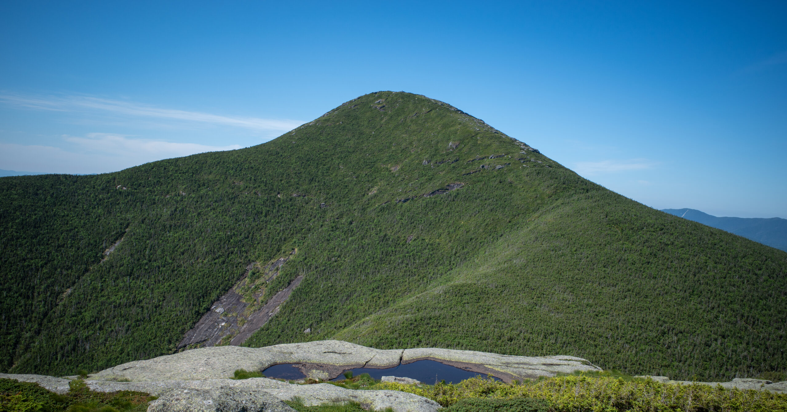
The direct view toward Algonquin defined the summit for me. Algonquin rose immediately beyond the connecting terrain and looked much larger than I had understood from distant viewpoints. That perspective alone made Wright worth adding.
Wright Junction to Algonquin Peak
After the Wright side trip, the main route resumes with steeper rock in the forest before rising onto Algonquin’s exposed upper mountain.
I returned to the signed junction and continued toward Algonquin. The climbing became steeper and rockier, including places in the forest where I scrambled up steep rock. Higher still, the route emerged above treeline and continued over open bedrock.
Navigation remained clear in the dry, bright conditions I had. Clear markings did not remove the physical challenge. The accumulated ascent, steep surface, and exposure still make this a serious mountain route for someone without prior experience.
I spent about 15 to 20 minutes on Algonquin’s summit. More people were present than on Wright, but the summit did not feel oppressively crowded during this visit. A summit steward was working, and I spoke with hikers who were progressing through the Adirondack 46ers.
Other hikers helped me identify Mount Marcy and Mount Colden, including the visible slide scars on Colden.
Descent to the Adirondak Loj Area
The return reverses the same steep terrain, so the summit is a midpoint in effort and attention rather than the end of the work.
I descended from Algonquin to the Wright junction and continued toward the trailhead without repeating Wright. The route remained easy to understand, but descending the steep rock required care even when it was dry.
Lower on the route, another hiker let me use a Sawyer Squeeze at a flowing creek with a small waterfall-like appearance. I topped off and drank more freely. I believe I could have finished without the refill, but I would carry my own treatment method next time rather than plan around an unconfirmed source or another person’s equipment.
Difficulty and Scrambling
The combined hike is strenuous but not extreme, with difficulty coming from sustained climbing, steep rock, light scrambling, and exposed upper terrain.
The scrambling is intermittent rather than a continuous technical obstacle. On both peaks, I encountered steep rock where hands helped with balance or upward movement. Wright’s upper route and Algonquin above treeline also remove the protection of the forest.
This route is reasonable for hikers who already know how they respond to long mountain climbs and steep Adirondacks rock. I would not recommend it to an absolute beginner. Seeing hikers of many ages complete the route during my visit does not make age a useful substitute for preparation, fitness, or comfort on the terrain.
My later Giant Mountain and Rocky Peak Ridge hike felt harder overall because the descent and re-ascent between those summits created a more sustained grind. Giant alone may be broadly comparable to Algonquin in feel, but that is a qualitative impression, not a statistical comparison.
Navigation Notes
The route felt straightforward in clear summer conditions, with the Wright split signed prominently and upper rock markings keeping both summit approaches legible.
I bought a paper map at the High Peaks Information Center and spoke briefly with a nearby ranger about the day. Use a current official map for the lower approach and exact trail names.
The major route logic is simple: take the Van Hoevenberg Trail and Algonquin Trail to the Wright Peak Trail Junction, complete the spur to Wright Peak as an out-and-back, return to the junction, continue on the Algonquin Trail, then reverse the approach. Above treeline, remain on the marked route and bare rock. Do not cut across the alpine vegetation even when another line looks easier.
Clear weather made the markings easy to see during my hike. Fog, cloud, darkness, snow, or ice could make exposed navigation more consequential, so a map and offline navigation remain appropriate even on a popular route.
Water and What I Carried
I carried a 2.5-liter hydration bladder and simple trail snacks; an unplanned treated refill lower on the route let me drink more freely, though I believe I could have finished without it.
I carried a 2.5-liter hydration bladder and simple trail snacks. The late June day was warm, and the exposed upper mountains offered no shade. Personal water needs vary, so my amount should not be treated as a recommendation.
The lower creek refill was useful but not part of my plan. I cannot confirm the source’s name, seasonal reliability, or current condition. Carry enough water for the forecast and your own consumption, and bring your own treatment method if you intend to use backcountry water.
Weather and Alpine Considerations
My warm, clear, dry day made the rock and navigation more forgiving than they would be in wet, icy, cloudy, or stormy conditions.
The rock was dry, the sky was exceptionally clear, and any mud was insignificant. It was somewhat windy above treeline while still warm. Bugs were present but manageable. Those observations describe one late June day, not a dependable seasonal pattern.
Wet rock would likely reduce traction on the slabs and scrambling, but I did not hike this route in rain. Above treeline, exposure also increases the consequences of wind, fast-moving storms, and poor visibility. Check a mountain forecast, carry layers and a headlamp, and turn around when conditions no longer fit the plan.
NYSDEC lists the High Peaks Wilderness as open year-round, but seasonal conditions change the route substantially. Snowshoes or skis are required when snow depth reaches at least eight inches. Spring muddy-trail advisories can also ask hikers to avoid high-elevation routes to protect thin soils and fragile vegetation.
Protect the summits: Algonquin and Wright support fragile alpine habitat. Follow rock markings and steward instructions, stay on the established route and bare rock, and keep off plants and thin soil.
Crowds and Parking Pressure
Popularity is the route’s main weakness, affecting both the trail experience and the reliability of the parking plan.
I hiked on a Monday and still saw people consistently. Wright had a handful of hikers at the summit, while Algonquin was busier. Neither summit felt unmanageably crowded, but this was never a solitude-oriented day.
The crowd level did not bother me much because I expected these peaks to be popular. It did change the character of the hike. Conversations with the summit stewards and Adirondack 46ers added to the experience, while the steady presence of other hikers reduced any sense of remoteness.
Parking deserves equal attention. ADK says its summer lots often fill before 6 a.m. on weekends and before 9 a.m. on weekdays. My lot also looked fairly full after a Monday hike. Begin early, prepare an alternate objective, and never treat an early arrival as a guarantee.
What I Would Do Differently
I would keep Wright in the plan, carry my own water treatment, and seriously evaluate an Iroquois Peak extension before the hike rather than discovering the option at the summit.
- Bring my own filter or another reliable treatment method instead of benefiting from someone else’s Sawyer Squeeze.
- Study the full Algonquin and Iroquois route on a current map before leaving the trailhead.
- Decide in advance what weather, energy, water, and turnaround conditions would make an Iroquois extension reasonable.
- Keep Wright as a meaningful objective, repeating it only if time and energy still supported the larger plan.
Iroquois Peak was not part of this hike. On a future visit, I would strongly consider adding it from the Algonquin area, but it is additional mountain travel rather than a free or automatic bonus. This guide does not provide mileage, elevation, or navigation instructions for an extension I did not hike.
Is the Algonquin and Wright Hike Worth It?
Yes for experienced hikers who want two exposed High Peaks and accept steep rock, sustained effort, busy trails, and possible parking pressure.
Wright’s direct view toward Algonquin was one of the best moments of the day, and the side trip felt fully worthwhile. Algonquin remained rewarding on a second visit, with broad open views, a sociable summit, and a perspective across Mount Marcy and Mount Colden.
The route combined straightforward navigation with steep rocky climbing and exposed summits. That balance makes it an excellent marquee Adirondacks day hike for someone who is already comfortable in mountain terrain. The crowds and parking pressure are real limitations, not reasons to dismiss the route.
For me, the deeper value came from returning roughly a decade after my first ascent. Algonquin had not become easy. I had become stronger, fitter, and more experienced. The contrast gave the summit a personal meaning that a first ascent could not have provided.
For a quieter short hike with a distant view of both peaks, see my Mount Van Hoevenberg East Trail guide. For a shorter arrival-day or departure-day option in Keene Valley, see my Rooster Comb guide. For a harder two-peak comparison with a demanding descent and return climb, see the Giant Mountain and Rocky Peak Ridge guide.
Photo Highlights
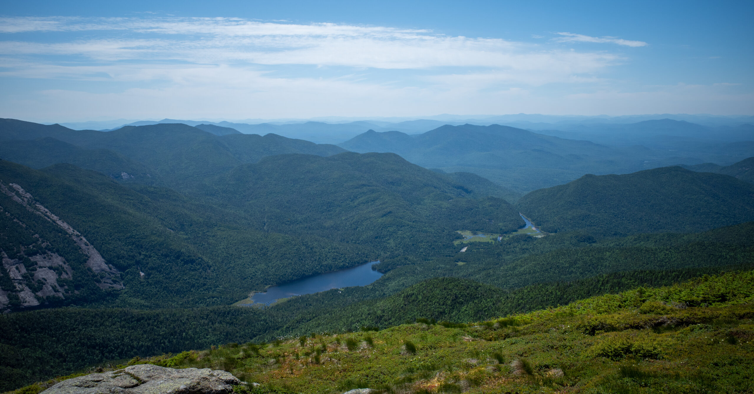
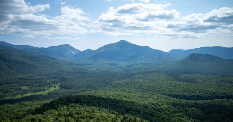
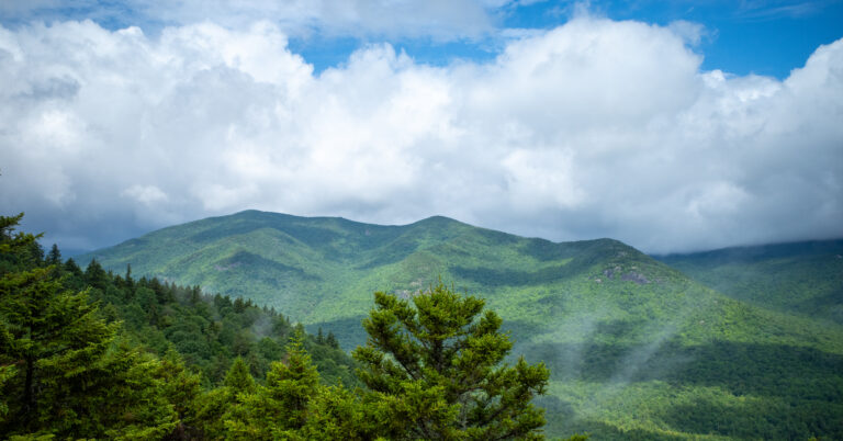
Two summit panoramas move from the direct view of Algonquin from Wright to Lake Colden, the Flowed Lands, and layered Adirondack ridges from Algonquin.