Rooster Comb Day Hike in Keene Valley
Rooster Comb was the shorter departure-day hike in my two-day Adirondacks day-hiking trip, after Wright Peak and Algonquin Peak and before the return to New York City.
Hike Snapshot
| Location | Keene Valley, High Peaks Wilderness, Adirondack Park, New York |
|---|---|
| Hike Type | Day hike |
| Route Type | Out and Back with separate branches to the Rooster Comb summit and Valley View Ledge |
| Mapped Distance | 4.7 mi |
| Mapped Elevation Gain / Loss | +1,820 ft / -1,820 ft |
| Trip Date | Early July 2025 |
| Group | Solo |
| Difficulty | Moderate, with sustained forest climbing and some steeper portions |
| Terrain | Predominantly forested trail, constructed stone steps, and exposed rock at the summit and Valley View Ledge |
| Conditions | Light rain during part of the morning, then cloudy clearing near the summit and ledge |
| Parking | Small designated Rooster Comb trailhead lot on Route 73 |
| Facilities During My Visit | Portable toilets were present; current availability is not guaranteed |
| Best For | A shorter arrival-day, departure-day, or lighter-day objective for someone already in Keene Valley |
Scope of this guide: The route character, conditions, parking experience, and facilities describe my early July 2025 hike. Trail conditions, legal parking, facilities, access, and rules can change. Check the NYSDEC High Peaks Wilderness page and current Adirondack backcountry notices for your dates.
Overview
Rooster Comb is a worthwhile shorter Keene Valley hike with a well-maintained forest climb and a genuine exposed viewpoint, as long as it is treated as a supporting objective rather than a marquee High Peaks day.
I hiked solo on the second morning of a dedicated Adirondacks trip. After two nights in Saranac Lake, I packed up, drove south toward Keene Valley, and chose a route short enough to finish before continuing toward Newburgh and New York City.
I arrived fairly early, though not before dawn. The trailhead lot was empty, the morning was quiet, and light rain moved through during part of the hike. By the time I reached the upper exposed rock, the rain had cleared and the clouds were beginning to lift across the valley.
The hike delivered what I wanted from that morning: moderate climbing, a maintained trail, enough open rock to feel like a mountain viewpoint, and a broad look across Keene Valley without consuming the rest of a travel day. The tradeoff is equally clear. It did not have the scale, challenge, or views of Algonquin Peak and Wright Peak, and I would not make a dedicated Adirondacks trip for Rooster Comb alone.
Route Map
The embedded CalTopo map shows the 4.7-mile route I used from Route 73 to the Rooster Comb summit, followed by the short side trip to Valley View Ledge, with a mapped +1,820 ft / -1,820 ft. Use the current regional route guide and NYSDEC information alongside it for present trail and access details.
GPX note: The download contains the mapped route from the Rooster Comb trailhead to the summit, the Valley View Ledge side trip, and the parking-area waypoint. It has no timestamps or elevation samples, so treat it as a route reference rather than a timed activity record or current conditions report.
Statistics: CalTopo’s raw profile values are 4.68 mi and +1,823 ft / -1,823 ft. The Snapshot rounds those mapped values to the site’s display standard. Start, finish, moving time, and elapsed time are omitted because this line contains no timestamps.
Quick Route Summary
The mapped 4.7-mile route shares one main forest climb, visits the Rooster Comb summit first, adds the short Valley View Ledge side trip, and returns to Route 73.
- Trailhead to forest: Leave the designated Route 73 trailhead area and follow the current signed route toward Rooster Comb.
- Main climb: Continue on the shared forested approach, including numerous constructed stone steps and some steeper portions.
- Rooster Comb summit: At the upper branch, follow the summit route to exposed rock, then return to the same junction.
- Valley View Ledge: Take the separate short spur to the second open view, then return to the shared route.
- Descent: Reverse the main approach to the Route 73 parking area. I passed other hikers ascending, but the trail did not feel busy during my early visit.
Use the map, current trail signs, and an offline copy of the route rather than relying on memory alone.
Trailhead and Parking
| Official Parking Area | Rooster Comb Trailhead Parking Area on Route 73 |
|---|---|
| NYSDEC Location | Approximately 44.1855, -73.7869 in the Town of Keene |
| Nearest Community | Keene Valley |
| Parking Capacity | No current official capacity found; treat this as a small lot |
| Recreation Fee | NYSDEC lists the High Peaks Wilderness as free |
| Current Access | NYSDEC lists the High Peaks Wilderness as open for recreation year-round; check live notices before leaving |
| Trail Register | The current regional route page documents a register near the start; sign in and out if it is present |
| Facilities During My Visit | Portable toilets were present in 2025, but current or year-round availability is not confirmed |
My parking experience: The obvious off-road lot was empty when I arrived fairly early. It looked small, but I am not assigning it an official capacity. An early start can reduce uncertainty and summer heat; it does not guarantee a space.
Where to park: Use only legal, designated parking. NYSDEC enforces Route 73 no-parking zones, so do not assume an unmarked shoulder is a legal overflow option.
Route Guide
Most of my morning was a moderate forest climb, followed by the Rooster Comb summit and a short side trip to Valley View Ledge as the weather began to clear.
Forested Climb and Stone Steps
A maintained tread and frequent constructed steps made the sustained climbing feel manageable without making it flat or effortless.
The route was predominantly forested. During my visit, the trail was well maintained and included many constructed stone steps. The grade felt gradual or moderate through much of the climb, with steeper sections that added effort but never felt unusually difficult to me.
Light rain fell during part of the morning. The forest remained manageable and the trail did not become significantly muddy during the conditions I experienced. Wetter conditions may make the route harder or unsafe.
The maintained character helped, especially on a short travel-day objective. I carried one trekking pole and appreciated having it, but the trail still required normal attention on wet stone and steeper ground.
Rooster Comb Summit and Valley View Ledge
The summit and short Valley View Ledge spur add two exposed stops to a hike that is otherwise predominantly forested.
I reached the Rooster Comb summit first. After returning to the upper junction, I followed the short spur to a second view. My supplied map and the current regional route description identify that spur as Valley View Ledge.
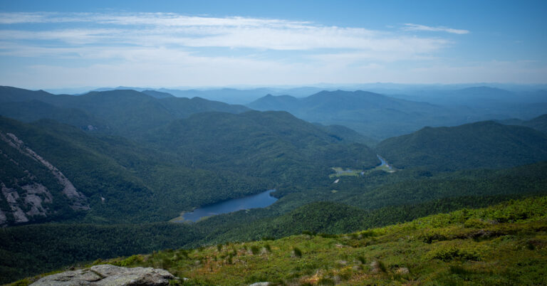
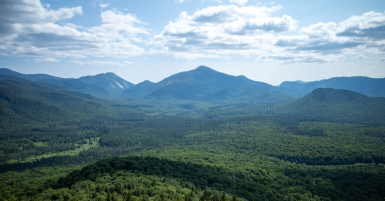
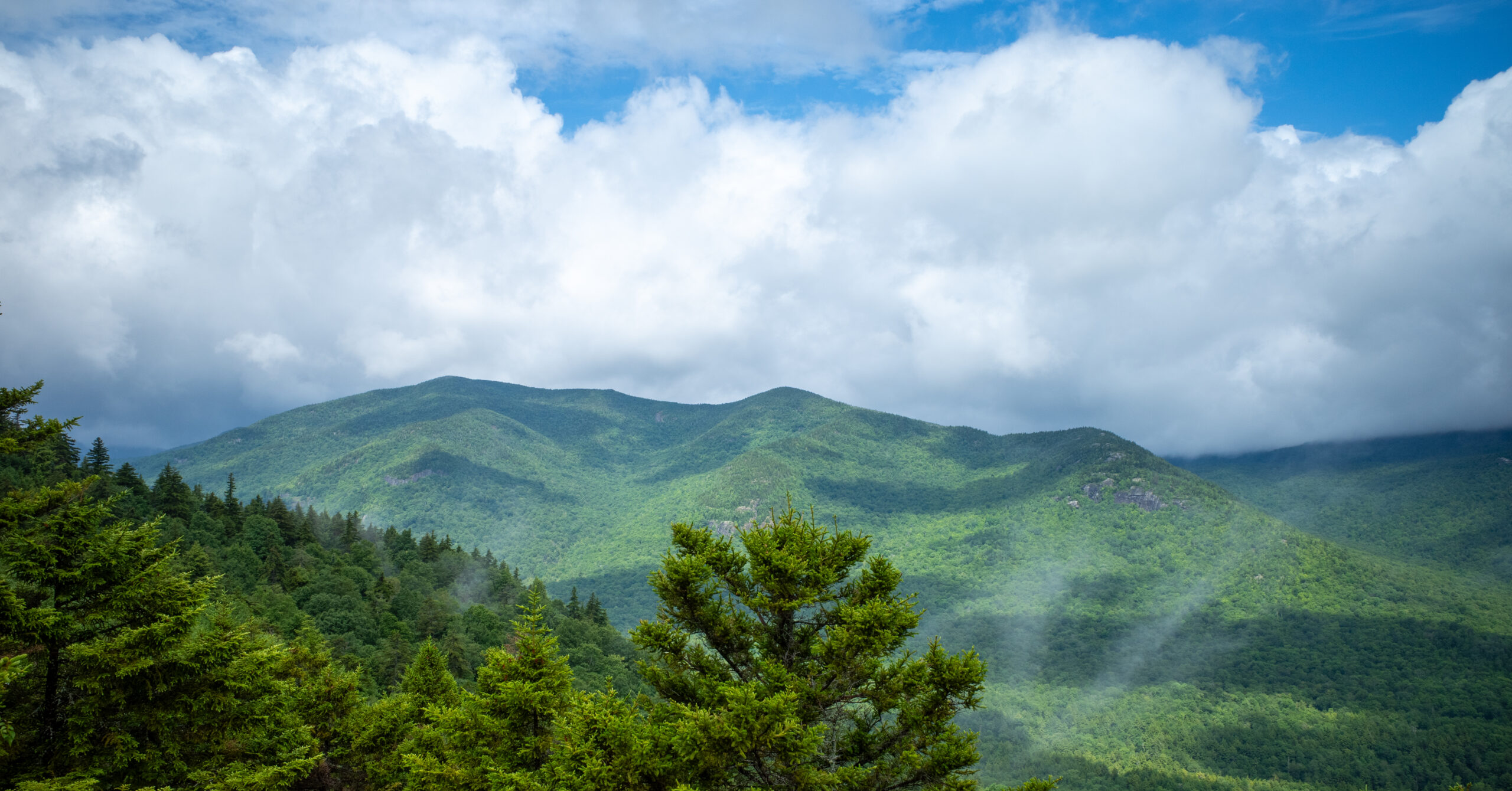
The weather had cleared by then, though clouds still hung over the surrounding ridges. I spent roughly 10 to 15 minutes at the exposed upper area and had the view to myself. I believe the featured photograph comes from the short viewpoint spur.
I could not confidently identify the individual mountains in front of me. Other hikers were ascending while I descended, but my early visit never felt busy. That quiet should not be read as a promise of solitude on another date.
Difficulty and Trail Conditions
The mapped 4.7-mile route with 1,820 feet of gain felt moderate to me: shorter and more manageable than a major High Peaks route, but still a sustained mountain climb.
The route was not especially challenging for me as an experienced hiker. The stonework and maintained tread helped, and I did not encounter scrambling that defined the day. Some steeper portions still required effort, and the exposed rock deserves care when wet.
In overall scale and effort, it reminded me more of Cat Mountain from Edgecomb Pond and Mount Van Hoevenberg via the East Trail than of a long High Peaks combination. Their mileage, climbing, and terrain differ.
Rain can change footing quickly in the Adirondacks. My morning stayed manageable and did not become significantly muddy, but different rainfall, temperatures, or recent storms could produce a very different trail.
Navigation Notes
Bring the GPX or another current offline map and follow present trail signs because the route branches near the summit and connects with a wider trail network.
The confirmed route goes to the Rooster Comb summit first and then uses the separate short spur to Valley View Ledge.
Review the official planning resources before leaving service, save the route offline, and confirm your position at each upper branch. Use the trail register if it is present, and do not rely on this article as a substitute for navigation.
Weather and What I Carried
A normal day pack, rain shell, trekking pole, snacks, and drinking water were enough for the short wet-weather morning I experienced.
I carried a water bladder, trail snacks, one trekking pole, and a rain shell. I do not remember my exact water quantity. I needed less than on the much longer High Peaks hike from the previous day, but that personal experience is not a universal water recommendation.
The rain shell was the most relevant item for the weather. There was no thunder or lightning during my hike, and the rain had cleared by the time I reached the exposed rock. Check the current forecast and be willing to change plans if the upper terrain, wind, rain, or thunderstorms make the objective inappropriate.
What I Would Do Differently
I would keep the early travel-day timing, but on a future Keene Valley trip I would probably use the same window for another short hike.
Rooster Comb fit this trip well. I would still arrive early, keep enough schedule margin for changing conditions, and treat the day as a real mountain hike rather than an incidental roadside stop.
I enjoyed Rooster Comb, but Keene Valley has many worthwhile shorter objectives, and on my next Adirondacks visit I would probably use a limited morning to see a different route.
Is Rooster Comb Worth Hiking?
Yes, when you are already in Keene Valley or need a shorter Adirondacks objective with an exposed summit and a second short viewpoint spur.
Rooster Comb offers good value for the time and effort. The forested climb is maintained and moderate, the constructed steps make the route feel purposeful, and the summit-plus-ledge finish opens to broad valley views rather than ending at a wooded high point.
Its limits matter. The view did not compare with Algonquin Peak or Wright Peak, and the route did not deliver the challenge of a longer outing such as Giant Mountain and Rocky Peak Ridge. I would not travel all the way to the Adirondacks solely for this hike.
As an arrival-day, departure-day, or lighter-day hike, Rooster Comb is a satisfying shorter objective rather than a substitute for a major High Peaks day.
Photo Highlights
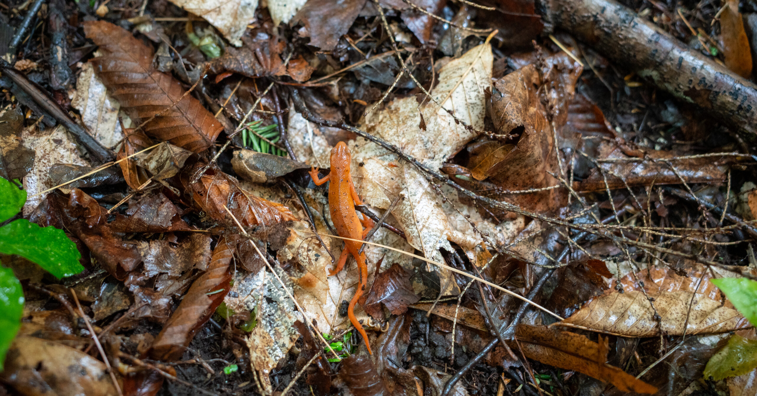
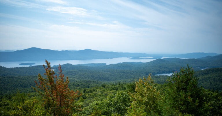
Two frames pair a cloudy ridge view likely from the short upper spur with a small salamander on the damp forest floor.