Mount Van Hoevenberg East Trail Day Hike
I hiked Mount Van Hoevenberg on the arrival day of my three-day Adirondacks day-hiking trip, which covers the full sequence, lodging and transportation plan.
Hike Snapshot
| Location | Mt Van Hoevenberg Olympic complex near Lake Placid, New York |
|---|---|
| Route | Mt Van Hoevenberg East Trail from the Olympic complex |
| Route Type | Out and Back |
| Mapped Distance | 3.7 mi |
| Mapped Elevation Gain / Loss | +960 ft / -960 ft |
| Mapped Elevation Range | 2,024–2,929 ft |
| Official Estimates | Approximately 3.4–4.7 miles round trip and 920–1,000 ft of gain, depending on the published starting point |
| Summit Elevation | 2,940 ft |
| Difficulty | Moderate; steady climbing on a well-built trail with no meaningful scrambling |
| Trip Date | July 2026 |
| Start / Finish | Approximately 2:30 p.m. / 4:30 p.m., including time on the summit ledges |
| Conditions | Sunny, dry, and warm, with substantial shade on the ascent |
| Group | Solo |
| Best For | An arrival-day, departure-day, warm-up, or lower-effort Lake Placid hike with unusually strong views |
Scope of this guide: The route, parking experience, trail conditions, crowds, and timing describe my July 2026 hike. Parking assignments, venue operations, lodge services, trail access, and conditions can change. Check the official Mt Van Hoevenberg hiking page, daily trail report, and NYSDEC Adirondack backcountry notices before leaving.
Overview
Mount Van Hoevenberg delivered a much larger High Peaks view than I expected from a short, moderate afternoon hike.
I hiked the East Trail solo on my arrival afternoon after driving from the New York City area. Starting around 2:30 p.m. gave me enough time to climb at a comfortable pace, spend a meaningful break on the summit ledges, and return around 4:30 p.m. The two-hour window reflects my pace and conditions on that day, not a universal completion time.
The route begins inside an active Olympic recreation complex, which makes the opening feel more like navigating a sports campus than arriving at a conventional Adirondack trailhead. Once I passed the trail register and entered the woods, that ambiguity disappeared. The trail was well marked, notably well maintained, and moderate rather than severe.
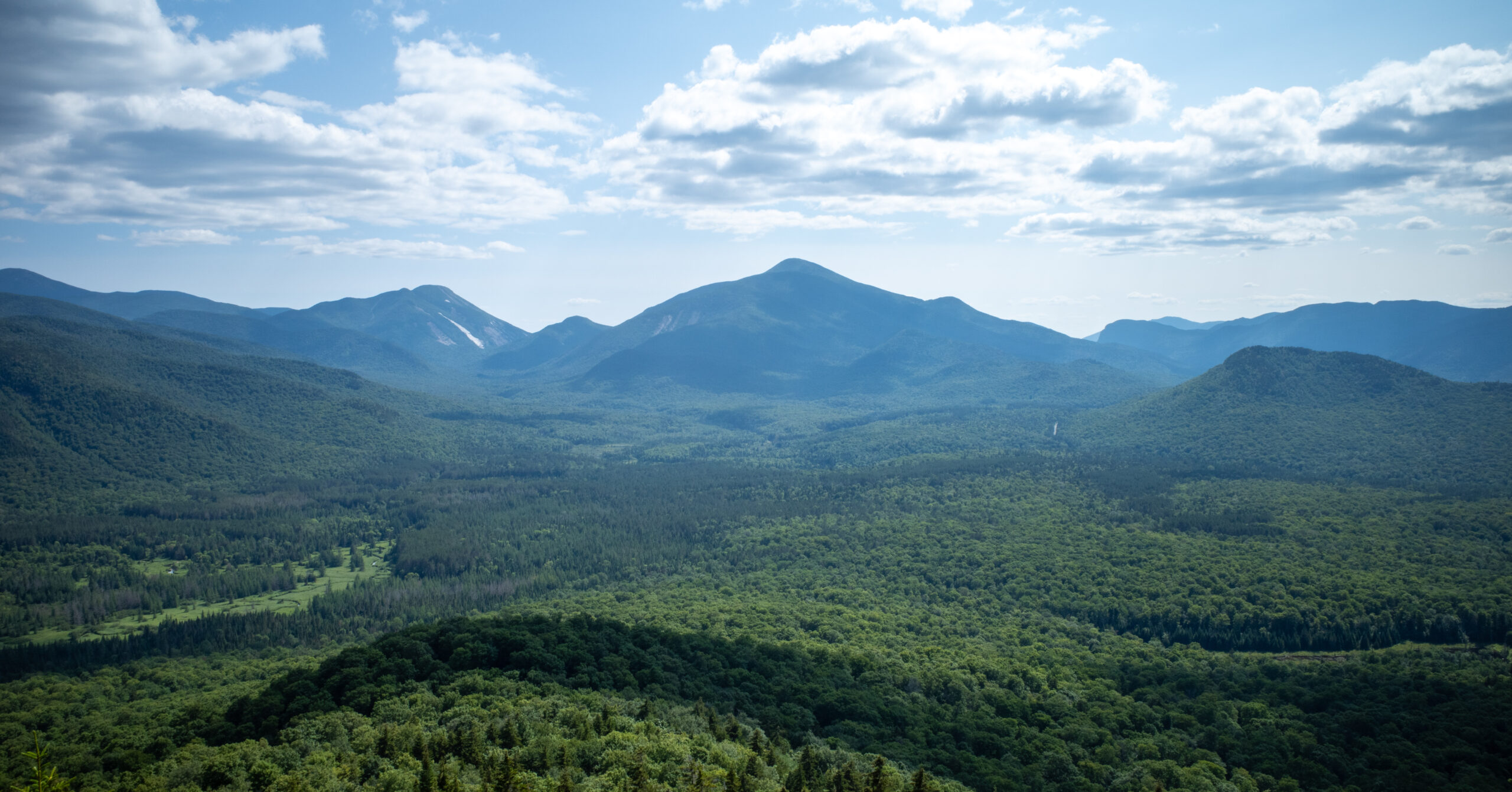
The summit ledges were the reason the hike exceeded expectations. The view reached across Algonquin, Mount Marcy, the Great Range, and many surrounding High Peaks. I would not plan a long Adirondacks trip solely for Mount Van Hoevenberg, but I would gladly add it to another Lake Placid visit.
Route Map
The embedded CalTopo map shows the 3.7-mile out-and-back route from the Olympic complex. Use the official Mt Van Hoevenberg map alongside it to understand Lot A, the Mountain Pass Lodge, and venue layout.
GPX note: The download contains the mapped Mount Van Hoevenberg East Trail out-and-back. It has no timestamps or elevation samples, so the guide’s distance and elevation figures come from the CalTopo profile. Treat it as a route reference, not a current report on parking, access, facility operations, rules, or trail conditions.
Distance note: CalTopo measures the mapped route at 3.65 miles with 958 feet of gain and loss, displayed here as 3.7 miles and +960 ft / -960 ft. Official estimates vary with the starting point: ORDA lists 4.7 miles round trip from the Olympic complex, while NYSDEC describes the East Trail itself as 1.7 miles one way with 920 feet of climbing.
Why This Works as an Arrival-Day Hike
The route is short enough to fit after a drive, substantial enough to feel like a real hike, and rewarding without demanding an early-morning trailhead start.
After several hours in the car, I wanted to move without spending the rest of the day on a major objective. Mount Van Hoevenberg fit that role extremely well. The moderate grade let me settle into hiking, while the two-hour outing left enough margin to enjoy the ledges rather than treating the summit as a turnaround deadline.
This is also a useful departure-day or lower-effort option. It provides a genuine mountain panorama without the mileage, scrambling, or planning commitment of many High Peaks routes. The tradeoff is atmosphere: the approach passes through an Olympic venue, and the trail is designed for regular use rather than remoteness.
Trailhead and Parking
| Official Address | 31 Van Hoevenberg Way, Lake Placid, NY 12946 |
|---|---|
| Parking | Lot A for East Trail hikers, according to ORDA’s current parking instructions |
| Fee / Reservation | ORDA lists hiking as free and advertises unlimited free parking. Its ticket page says reservations are strongly recommended but does not state a hike-specific reservation requirement; event operations can change normal access |
| Trail Access | At an August 13, 2026 check, ORDA’s latest posted report was dated August 12 and listed East Trail access as open from 12:00 a.m. to 11:59 p.m.; check the live report for your date |
| Lodge Hours | The Mountain Pass Lodge was listed as open 9:00 a.m. to 5:00 p.m. in ORDA’s August 12 report; trail access and building access are separate |
| On-Site Services | ORDA lists food, retail, and restrooms at the complex; I observed the lodge but did not personally use or verify the indoor facilities |
| Drinking Water | No current official hiker water-refill source was confirmed; arrive with the water you need |
| Registration | ORDA places the East Mountain Trail Head Registration Kiosk beyond the outrun of the 1980 track |
| Seasonal Access | ORDA lists the hiking venue as year-long, and NYSDEC lists the High Peaks Wilderness as open year-round |
My parking experience: I parked in Lot A during my July 2026 visit. Parking was free, the lot had ample space, and I had no parking stress.
Follow current signs: ORDA’s dedicated parking page and current hiking instructions direct East Trail hikers to Lot A. An older line lower on the hiking page still says Lot 3, so use the current parking page, daily report, and posted venue signs rather than that stale reference.
Finding the East Trail
The opening is mildly confusing because the route crosses an active recreation complex before it looks like a conventional mountain trail.
From Lot A, I walked toward the Cliffside Coaster, turned left, and continued uphill past buildings. I then found a trail sign and register, turned right, and entered the woods. ORDA describes the registration kiosk as being beyond the outrun of the 1980 track.
The sequence was manageable because signs pointed me through the venue, but it did not initially feel like I was at a normal trailhead. Operations and event setups can change the walk across the complex, so follow the posted East Trail signs even if they differ from the route I followed during my visit.
Route Guide
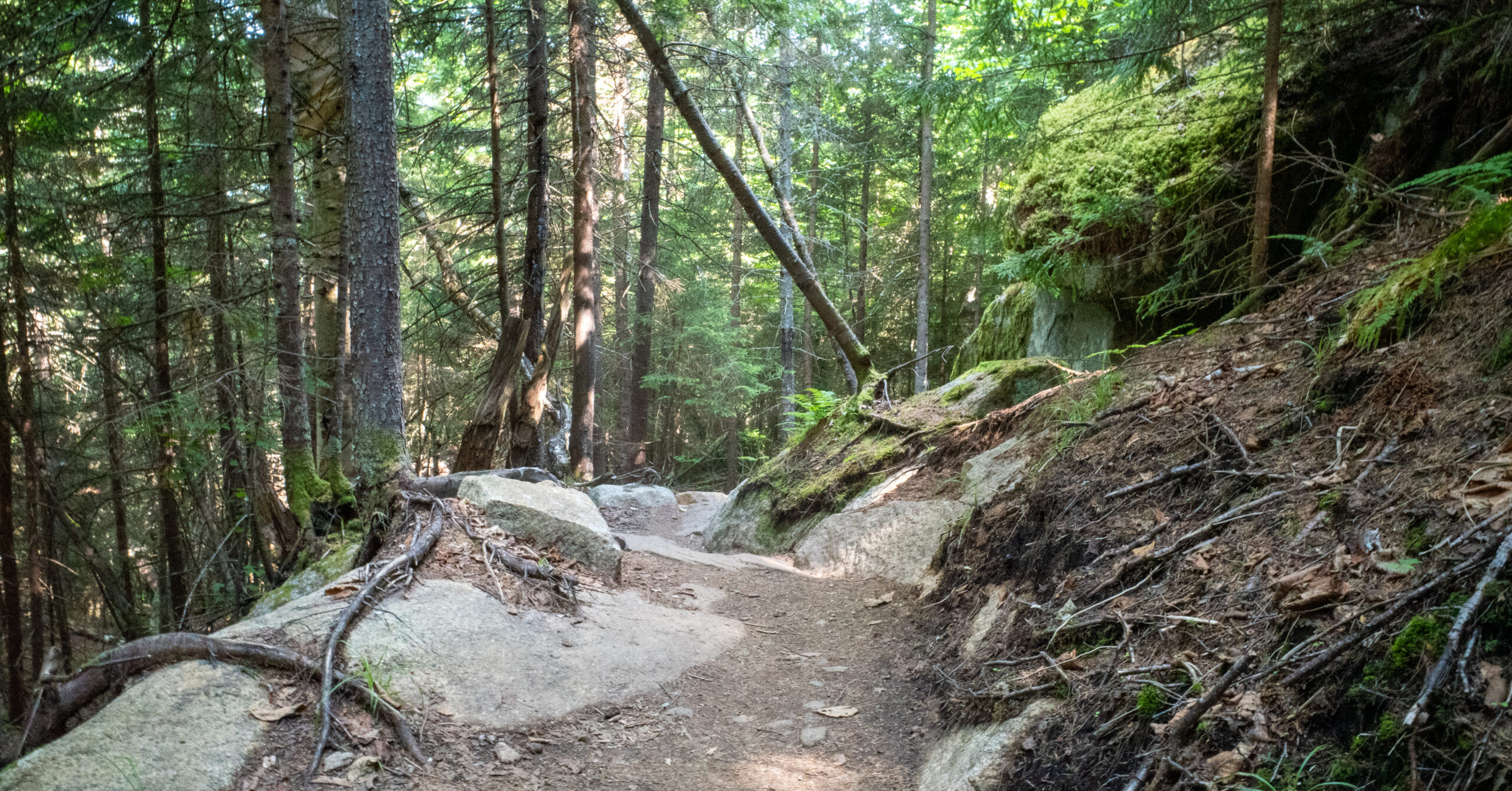
Beyond the register, the East Trail climbs steadily through shaded woods on roots, dirt, switchbacks, and carefully built stonework.
Register to the Lower Switchbacks
The route enters the woods quickly and settles into an easy-to-follow climb on a hardened, well-drained tread.
Once I turned right at the register, route-finding became straightforward. Markers were frequent enough that the trail would have been difficult to lose in normal daylight. Some sun reached the lower trail, but the tree cover soon provided useful shade.
The lower ascent combined ordinary Adirondack dirt and roots with obvious modern trail construction. Flat stone steps appeared in places, and the switchbacks kept the grade from becoming severe.
Steady Climb Through the Woods
Most of the hike is a moderate forest climb that asks for steady effort without introducing meaningful scrambling.
The trail continued on dirt, roots, stone steps, and smooth switchbacks. Nothing required a true hands-on move, and I never encountered a section that felt exposed or technically difficult. The grade was consistent enough to feel like a workout, but it was not punishing.
The maintained character is one of the route’s defining features. ORDA describes the trail as a model of sustainable construction, with bench cuts, low-rise steps, and drainage designed for regular use. That matched what I saw on the ground.
Summit Approach and Return
The wooded climb ends at open ledges, then the return simply retraces the same marked route to the Olympic complex.
The final approach remained moderate, with no last-minute scramble before the view. The transition from shaded trail to open rock made the summit feel more dramatic because the panorama arrived suddenly.
After spending time on the ledges, I descended the same way. The maintained steps and moderate grade made the return straightforward in dry conditions. Back at the register, I reversed the signed walk through the complex to Lot A.
Summit Ledges and Views
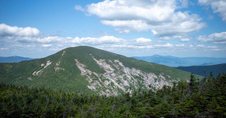
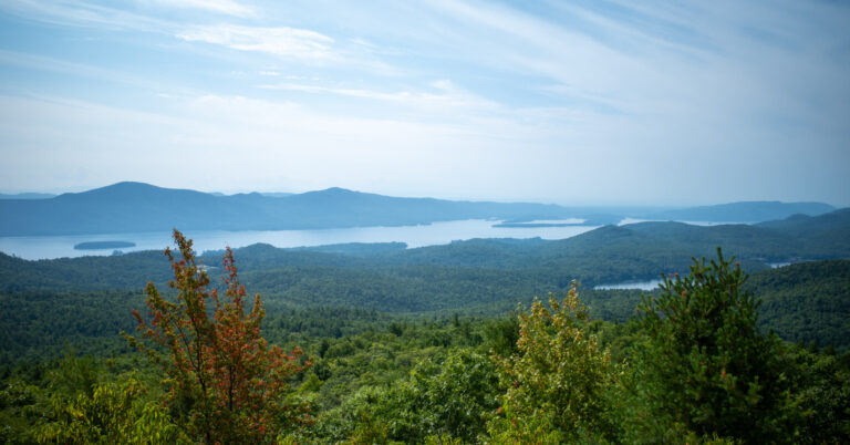
The exposed summit ledges create an almost 180-degree High Peaks panorama that feels much bigger than the climb required to reach it.
The ledges were open to the sun and broad enough to sit, look across the landscape, and take time with the view. I could identify Algonquin and Mount Marcy in the distance, with the Great Range and numerous surrounding High Peaks filling the horizon.
A few other hikers were present, but the ledges did not feel crowded during my afternoon visit. The summit atmosphere was still social rather than remote, which fit the route’s accessible Olympic-complex start. The view, not solitude, was the reason the hike was so rewarding.
Navigation Notes
Navigation is mildly awkward inside the venue and easy once the marked East Trail enters the woods.
The Olympic complex is the only place where I had to slow down and confirm the route. Signs made the approach manageable, but the buildings, coaster, tracks, and service paths do not resemble a typical trailhead. The official venue map is useful for that first section.
Beyond the register, the trail was well marked and visually obvious. I did not backtrack or have trouble at a junction. Carry an offline map anyway, and bring a headlamp if an afternoon start could extend toward darkness. Easy navigation in dry summer daylight does not eliminate normal mountain preparation.
Conditions and Seasonal Considerations
My warm, dry July conditions made this a straightforward hike, while the open ledges and year-round access require a different assessment in wet, icy, or snowy weather.
The afternoon was sunny and warm, but shade covered much of the ascent and kept the temperature manageable. Some sun reached the lower trail, while the summit ledges were fully exposed. The ground was dry, and bugs were not a meaningful problem during this visit.
ORDA lists the hiking venue as year-long. That does not make every season equivalent. Wet stone can change footing, the ledges can be windy and exposed, and winter snow or ice can materially increase the difficulty. NYSDEC requires skis or snowshoes in the High Peaks Wilderness when snow depths reach at least 8 inches. Carry appropriate traction when conditions warrant it.
Current access check: At an August 9, 2026 prepublication check, ORDA’s latest posted report was dated August 8 and listed the East Trail as open. Check the live report again on the day of your hike because venue operations and trail status can change.
Is Mount Van Hoevenberg Worth Hiking?
Yes when it complements a Lake Placid trip, especially as a travel-day warm-up or a lower-effort alternative with excellent scenery.
Mount Van Hoevenberg offers unusually good bang for the buck. The moderate trail, manageable schedule, and broad ledge views make it highly rewarding for the time and effort. It is also one of the nine peaks in the official Lake Placid 9’er challenge.
I would not travel to the Adirondacks solely to complete this hike, and the active Olympic complex reduces the sense of remoteness near the start. It works best as a compact, scenic addition to an existing Lake Placid itinerary.
I would recommend it for an arrival afternoon, a departure morning, a warm-up before a harder objective, or a day when energy and weather do not support a longer route. For a much longer New York day hike with three summits and far more climbing, see my Wittenberg, Cornell, and Slide Mountain loop guide. Mount Van Hoevenberg succeeds for nearly the opposite reason: the mountain view feels much bigger than the commitment required.
Photo Highlights
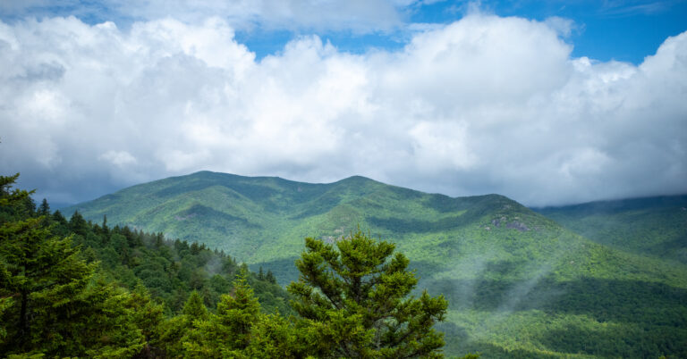
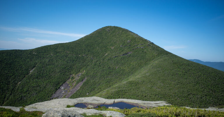
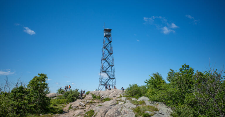
Two frames move from the summit’s High Peaks panorama to the shaded East Trail on the descent.